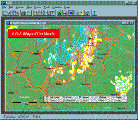
AGIS for Windows is a mapping and simple GIS shareware package. Plot your own geographic data on the map of the world provided without the high cost and steep learning curve usually associated with this kind of software.
AGIS for Windows is a mapping and simple GIS shareware package. Plot your own geographic data on the map of the world provided without the high cost and steep learning curve usually associated with this kind of software. Create high resolution publication quality images that can be pasted into popular packages such as MS Word. Animation, web serving, distance measuring, searching, GPS and integration with other systems such as databases are also supported. Import MapInfo .mif/.mid, ARCInfo text .e00 and arc generate, South African national exchange standard and Garmin GPS track files. Tutorials and additional support are available from the web site. Requirements: 256 color display Operating system: Win95,Win98,WinME,WinNT 3.x,WinNT 4.x,WinXP,Windows2000 Release notes: Major Update
Learn world continents and oceans the fun way. Includes 5 games. Continent and ocean names are spoken. A map of the globe is included.
Price: $0, Rating: 10, Downloads: 63 Download
Schmap France contains travel guides for nine popular French cities (including Paris, Cannes and Nice). Each guide comes with dynamic maps, useful links, playable tours, top picks, plus photos and reviews for 100s of attractions, restaurants, shops.
Price: $0, Rating: 7, Downloads: 60 Download
Satellite Image Browser is a Shareware Mac OS X application that can be used to display and print topographical satellite images.
Price: $20.00, Rating: 6, Downloads: 58 Download
Want to brush up on the names and locations of the 50 or so countries of modern Africa? This program from the Family Games Web Center will help you. A study mode and two quiz modes make the learning easy.
Price: $0.00, Rating: 10, Downloads: 50 Download
Visualize the location of all the countries of the world. Use as a reference to locate countries whose location you are curious about. Use it to test your knowledge of the world by having the program prompt you to find certain countries.
Price: $19.95, Rating: 8, Downloads: 49 Download
User Rating
Rating:2.2 out of
5 Based on13 ratings.
13 user reviews.